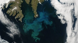
New Satellite Will Help NASA Keep PACE with Earth Systems - Eos
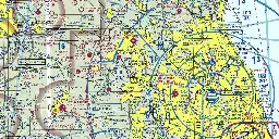
FAA Aviation Maps
Why Mercator for the Web? Isn’t the Mercator bad? - Mapthematics Forums
Placemark is now open source – web-based geospatial data editor
Still little evidence sex differences in spatial navigation are evolutionary adaptations
NASA Worldwind: An open-source high-res satellite globe for web pages
Only Computers Can Solve This Map-Coloring Problem From the 1800s | Quanta Magazine
4D Modeller project: A spatio-temporal modelling package that can be applied to problems at any scale from micro to processes that operate at a global scale.
PIGEON: Predicting Image Geolocations
CC0-licensed fantasy map brushes based on historical cartography
Geocomputation with Python
Bhoonidhi: Access to an extensive archive of Remote Sensing data from 44 satellites, including Indian and Foreign Remote Sensing sensors acquired since 1986.
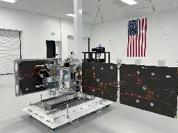
Startup That Monitors Space Threats Raises $100 Million to Expand Satellites
Desert Atlas: A Self-Hosted OpenStreetMap App for Sandstorm
City of Boulder Open Data
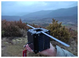
A nanosatellite and a hot air balloon for emergency broadband anywhere
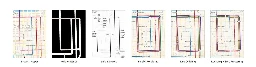
Computational modelling of terrains
A Technical Follow-Up: How We Built the World’s Prettiest Auto-Generated Transit Maps
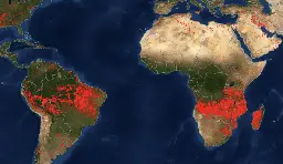
Scorched Earth: Using NASA Fire Data to Monitor War Zones - bellingcat
SpaceX says it’s ready to test sat-to-phone system with T-Mobile